Thursday, March 12, 2009

Favorite Pictures and Notes on the Blog


This page serves as an account of our journey down (or up) the Appalachian Trail during the Summer of 2008. Originally we planned on updating the blog while we were hiking, but blogging was one of the last things we felt like doing while on the trail. We made this page in order to provide our families, friends, ourselves and anyone interested in the AT with an overview of our trip. Our journey lasted about 75 days beginning at Springer and ending in Luray, Virginia - just shy of half the trail. The posts are arranged in chronological order with links to specific places located on the side menu.

Monday, March 2, 2009

First Day: Springer Approach Trail and Amicalola Falls


It's easy to remember the feelings of excitement leading up to the beginning of our journey. The drive up from Stockbridge Georgia to the approach trail at Amicalola Falls only took a couple of hours. As we got closer to the trail the skies got darker and darker and eventually we were stuck in a pretty serious thunderstorm. We figured there would be no better time than the present to begin so we signed in and set out on our two and a half month journey down (or up) the AT.

Mom and Dad wanted to hike a little with us and we were more than glad to have their company. They turned back after we had our first bear encounter a few miles in.

The view from the top of the Falls.

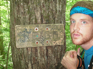
The official starting point


The view from Springer Mountain.

We hiked 13 miles our first day - mostly uphill and through the rain. Needless to say we were completely wiped out. Here is the shelter we stayed at our first night. It was one of the nicest shelters we saw on the entire trail. We met a crazy woman there who had a run in with a bear that stole her food a few hours before we arrived.

Sunday, March 1, 2009

The Beginning - Springer Mountain to the NC Line


The Georgia section of the AT is 75 miles long. The elevation is much lower than other sections of the trail, but its not an easy trek by any means. The weather was hot and the trail seemed to always be going up or down - never flat. There were lots of beautiful things to see which kept us going as we got our trail legs. I think our favorite part of the Georgia section was Blood Mountain.

A nice waterfall a few hundred meters off on a side trail during day 2.

Flame Azaleas in bloom during early June.

The face of pain - blister treatment.

Cliffs on top of Blood Mountain.

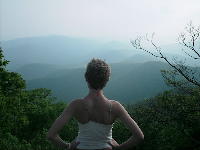
The view from Blood Mountain.

The fully enclosed shelter on top of blood mountain is typically a popular shelter but we had it all to ourselves as people got scared off due to the bear that stole someones pack that same morning - no sightings for us.

Rhododendron and Mountain Laurel in bloom on the descent from Blood Mountain.

The trail goes right through the Walasi-Yi center which was originally built by the CCC during the depression.

Our first campfire

Pretty forests.

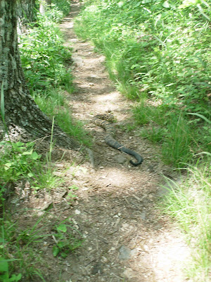
Rattlesnake Encounter - after some heavy stomping a few meters back he eventually slithered off the trail.

Jack in the Pulpit.

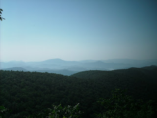
You don't get many good views in Georgia - especially during the summer when the trees are full of leaves. I would love to hike this section during the winter, but anyways here is a picture taken from a fire tower (if I remember correctly).

The Georgia/NC state line

Saturday, February 28, 2009

Lower North Carolina - Georgia Border to Nantahala River

We were very relieved and excited to get into the NC portions of the trail. Georgia was OK but in June the heat was relentless and we were seldom treated to a nice view after a long climb. North Carolina offers higher elevations and wide open balds which meant cooler temperatures and amazing views.
This was the first nice view we came to - on Sanding Indian mountain

The Rhododendrons re in full bloom on Standing Indian
After a tough climb up Albert mountain we were rewarded with great views from the fire tower.
A tunnel through a rhododendron thicket

Flame Azaleas in bloom

Wasilik Poplar - once the second largest poplar in the US (until it died a few years back) stands like a giant skeleton near rock gap.

We met an incredibly generous ex-hiker/trail angel in Franklin NC that drove us around gave us some good advice. We ate lunch at a local Cuban restaurant and had a couple delicious cold beers before hitting the trail later that afternoon.

Some wild strawberries - small but delicious
Some pictures from Siler Bald


Wayah Bald Fire tower.

I'm not sure what variety of Azaleas these are but they lined both sides of the trail near Wayah bald and smelled amazing.

It's a big ole moth - I think its a Luna Moth.

Giant ferns as tall as Jess lined the trail.

Friday, February 27, 2009

The Nantahala Gorge: the toughest day

We had a lot of tough days on the AT, but perhaps the toughest was the day we decided to go 20+ miles down into and out of the Nantahala Gorge. Everyone told us that the hike down into the gorge was horrible - steep downhill for 8 miles. To our surprise we felt great after making the trek down to the Nantahala Outdoor Center so we re-supplied ate lunch and a tub of ice cream each and then hit the trail. We considered spending the night in town, but we we decided to save a few bucks and hike on to the next shelter. I wouldn't say it was a mistake, but we we're hurting by the time we arrived. The hike out of the NOC was steep and the severe thunderstorm didn't make things any easier. We probably would have found a place to pitch our tent but who wants to do that in the rain - so we pressed on. At one point Jess, feeling particularly fatigued, resorted to drinking honey.
Luckily the shelter was nice and there was a great piped spring out front. Unfortunately it had one of the sickest privies on the trail.

Thursday, February 26, 2009

NOC to Fontana Dam

Not much to show from this section of the trail. I forget where this picture was taken, but it was our first glimpse of the smokies. We could see Clingmans Dome from this spot.
The Mountain Laurel blooms were falling and the ground was blanketed in white blossoms.
The Fontana Hilton was a pretty nice shelter, had a nice view of the lake, was close to the re-supply town, and had a great swimming hole. There were showers located a short distance from the shelter but we decided to forgo the luxury due to how squeaky clean we got on our afternoon swim.

The shelter was completely devoid of mice - perhaps due to this friendly black sanke that was living underneath the floor.

The Smokies: Best Multi-Day Period

We saw so many amazing places on our trip, but when trying to decide our favorite multi-day period the decision is easy. The Smoky Mountains portion of the trail was our favorite. It is one of the most diverse ecosystems on the planet. It has some of the most impressive scenery on the AT and most of the trail is on a ridgeline at high altitude. From the beginning at Fontana Dam to its end at Davenport gap this portion of the trail is filled with almost nonstop beauty.

Day 1
This picture was taken as we were crossing Fontana Dam on our way into the Smokies.
A Climb up An old rickety fire tower gives way to an amazing view of Fontana Lake.

The Smokies has one of the most dense and friendliest bear populations on the whole of the AT, but as long as you don't do anything foolish you chances of being attacked are very minimal. We were lucky enough to see a few while we were in the smokies (unfortunately they didn't stick around long enough for us to get a pictures).
Side Trail: Gregory Bald
We took this side trail on day one. I think the loop around was about 8 miles and it was well worth it. During mid June the Azaleas are in full bloom and Gregory Bald is home to some of very interesting types that you won't see anywhere else on the AT. The bald also affords great views of the surrounding park.

We found some friendly deer on top of the bald.
This was the shelter we stayed in (Mollies Ridge) after our first day on the AT. While most of the shelters on the AT are located in the gaps many of the shelters in the Smokies are located high on the ridge line. The nigh time temperature got down in the 30's which is pretty cold for mid June.

Day 2
It was a bit difficult rolling out of bed in the morning due to the cold temperatures, but we were very excited about the day ahead. The highlight of the day was definitely Spence Field. A long section of trail that was open on both sides. The mountain Laurel were in full bloom and the weather couldn't have been any more perfect.


We also came across the infamous "Rocky Top". I was happy to hear that the group that wrote the song had never been there or even heard about it - they just thought the name sounded good. It was a really beautiful spot and here is a picture of Jess showing her UT pride (mockingly of course).

So Lush and Green.

A nice sunset at Siler's Bald

Some of our AT friends Tim and Chuck on a cold morning in June after a night in Siler's Bald Shelter.

Day 3 This shot was taken on the way up to Clingmans Dome

We went up and over the highest point on the AT - Clingmans Dome (6,650ft). The view from the observation tower was nice. We were accustomed to experiencing the sites in realative solitude so it was a bit hard to enjoy due to the gawking crowds that come up to the observation tower from Gatlinburg.
The Dome itself was not nearly as impressive as the surrounding spruce-fir forest.

What a peaceful place to "murder a brown snake".

Supposedly the Mt. Collins shelter has a 9:00 bear that visits every night, I guess he wasn't hungry when we were there because that time came and went without a visit.

Day 4
We didn't take many pictures but most of the day was spent walking through the unbelievable misty Tolkieneske spruce-fir forests and spending the day re-supplying in Gatlinburg (I'll spare everyone from a rant about everything that is evil and wrong about that place).


After we had gotten our fill of pizza we headed back out to the trail. The shelters in the smokies are usually very crowded and typically take reservations which is impossible if you are a through hiker. If you are a through hiker you are required to stay in them, but if they get full because of section hiker reservations you have to pitch your tent. Understandable, but its a little inconvenient if someone shows up late. On this night it was full and we were happy to get out of the crowd and into our tent at Icewater Spring shelter.

Someone had released a peacock up there.

Day 5
We got up early to make sure we could get to Charlies Bunion when there wasn't a crowd. Its a popular spot as it is close to the road that bisects the park at Newfound Gap which is also roughly halfway through the smokies.

A nice rock outcropping that you can climb out on a hang your feet over the sheer cliffs.

Another picture of the trail.

Mt. Cammerer tower via a side trail - it would be a nice place to sleep, but you could face a stiff fine if you get caught.

Day 6
Not much to show for our last day in the park. This is one of the older shelters (Davenport Gap Shelter) in the smokies and it still has the bear cage on the front. The park service is now in the process of renovating the shelters. They are adding a covered cooking area to the front and getting rid of the cages (there are problems with people leaving food outside their shelters intentionally in hopes of seeing a bear - poor form).